NEWS, PRESS
RIEGL’s Airborne Bathymetric LiDAR – Revolutionizing Hydrographic Surveying
The following article by Janowski, Tysiąc, and Mandlburger provides a comprehensive understanding of Bathymetric technology, detailing its applications and benefits.

In their insightful article on Hydro International, Łukasz Janowski, Paweł Tysiąc, and Gottfried Mandlburger delve into the immense potential of airborne bathymetric LiDAR and RIEGL technology to revolutionize hydrographic surveying. They explore its applications in coastal zone management, floodplain analysis, and navigation safety, underscoring its indispensability in modern hydrographic surveys.
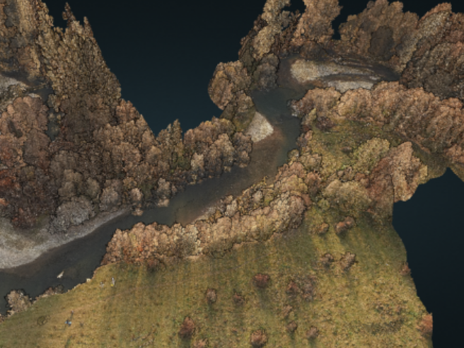
RIEGL is proud to highlight the transformative technological capabilities of the VQ-840-G airborne bathymetric LiDAR system, which is setting new standards in hydrographic surveying. Utilizing a pulsed green laser, our systems penetrate water surfaces to deliver precise data on underwater terrain, essential for environmental management, infrastructure planning, and disaster preparedness.
Our advanced LiDAR technology ensures minimal absorption and scattering in clear water, enabling accurate measurement of submerged features. The integration of a laser scanner, GNSS, and IMU in our systems guarantees high-resolution, geospatially accurate datasets.

Benefits of RIEGL Airborne Bathymetric LiDAR Technology:
- High-Resolution Data: Provides highly detailed and accurate maps of underwater topography, essential for various applications.
- Efficiency and Speed: Covers large areas quickly, making it more efficient than traditional survey methods.
- Versatility: Useful in coastal zone management, floodplain analysis, habitat mapping, navigation safety, infrastructure planning, and disaster preparedness.
- Penetration of Water Surfaces: Uses a green laser to penetrate water surfaces effectively, allowing accurate measurement of submerged features.
- Reduced Costs and Time: Reduces the time and costs associated with traditional survey methods, making it a cost-effective solution for large-scale surveys.
- Environmental Monitoring: Supports environmental monitoring by providing detailed data on underwater habitats and ecosystems.
For a deeper dive into the potential of airborne bathymetric LiDAR, read the full article: Charting depths from above with airborne bathymetric Lidar | Hydro International


