NEWS, TECHNOLOGY
LiDAR News Spotlight: Reimagining Infrastructure with Advanced RIEGL Mobile Mapping Solutions

LiDAR News recently had an interview with Katherine Hunt, CEO and Co-Founder of Teleqo Tech, where she highlighted the pivotal role of RIEGL‘s advanced LiDAR technology in revolutionizing the mobile mapping industry. Since its establishment in 2020, Teleqo Tech has specialized in end-to-end mobile mapping solutions, utilizing a variety of sensor types over the years. RIEGL‘s superior sensors and software have been integral for data collection, processing, extraction, and visualization. Since 2021, Teleqo Tech has collected over 50,000 miles of LiDAR and imagery data and extracted more than one million assets across the U.S. and Latin America for sectors like telecommunications, transportation, utilities, and smart cities.
Teleqo Tech chose RIEGL sensors for their superior quality and accuracy. The integration of RIEGL‘s VMY-2 mobile mapping system, including the RiACQUIRE collection interface and RiPROCESS suite, has significantly enhanced Teleqo Tech’s data collection efficiency. These tools streamline data capture and deliver unparalleled point cloud alignment, minimizing noise and misalignments, which in turn reduces processing time and increases efficiency during extraction.
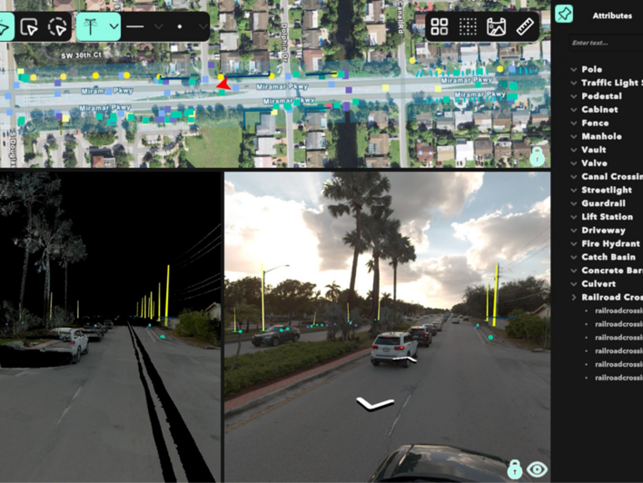
Their proprietary New Compass Solutions software, designed to be sensor-agnostic, seamlessly ingests data from all major mobile mapping hardware vendors, including RIEGL. This integration has enabled Teleqo Tech to tackle complex projects, such as a multi-level roadway infrastructure project in Texas and a dense urban telecom project in Miami, FL, with significant time savings and improved accuracy thanks to RIEGL‘s technology.

Looking ahead, Teleqo Tech sees mobile mapping as the cornerstone of future infrastructure development, leveraging 3D data from RIEGL‘s LiDAR technology for advanced capabilities like accurate change detection and precise measurements. Their focus on RIEGL-driven 3D data analysis ensures their projects meet the highest standards of accuracy, driving innovation and transformative solutions across industries.
Read the full article on this interview here: https://lidarnews.com/articles/reimagining-infrastructure-with-advanced-mobile-mapping-solutions/


