TECHNOLOGY, CASE STUDY
Precise and efficient high-frequency trajectory estimation for LiDAR georeferencing
Laser scanners mounted on moving platforms allow for efficient large-scale 3D mapping using light detection and ranging (LiDAR). Because the laser scanner is moving with respect to the earth, its trajectory (position and orientation over time) must be known in order to georeference the scanner measurements to an earth-fixed coordinate system. This is commonly realized through integration with satellite and inertial navigation systems. Sensor fusion algorithms, whether filter-based or adjustment-based, then fuse the navigation data to obtain an estimate of the platform trajectory. Errors in this trajectory cause errors in the 3D point cloud through the georeferencing process. Most processing workflows therefore include a step which optimizes the trajectory based on the LiDAR data itself.

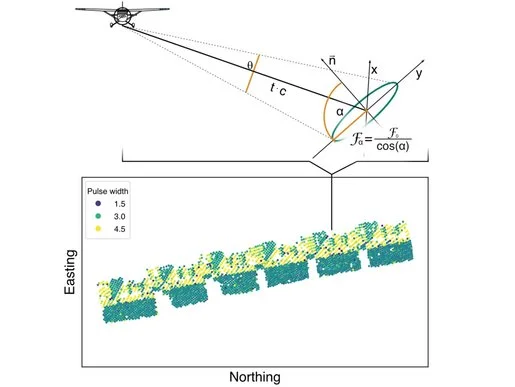
In this contribution, the authors focus on two related aspects of trajectory estimation and LiDAR georeferencing: Firstly, they analyze the impact of high-frequency trajectory dynamics, which cause oscillating errors in the trajectory and negatively impact point cloud precision if the inertial sensors’ sampling frequency is too low to properly resolve them. This implies the necessity of recording and processing inertial measurements at a sufficiently high frequency, which can drastically increase computational effort of the sensor fusion algorithm, especially for adjustment-based approaches. Thus, secondly, they propose a method for performing adjustment-based trajectory estimation with high-frequency inertial measurements which efficiently uses downsampled low-frequency inertial measurements within the adjustment while recovering the high-frequency trajectory dynamics from the original measurements. Analysis and processing are performed for two separate datasets acquired with two different platforms, a quadcopter uncrewed aerial vehicle (UAV) and a crewed fixed-wing aircraft. For the former, the authors demonstrate through analysis of point spread on planar surfaces that a 200 Hz sampling frequency for the inertial measurements is insufficient and leads to reduced point cloud precision. In both cases, the proposed methodology is shown to precisely recover the high-frequency trajectory while drastically reducing memory usage and runtime compared to performing the adjustment with the high-frequency inertial measurements.
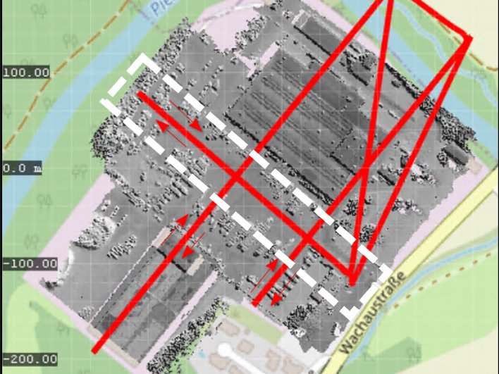
The first dataset is acquired with a quadcopter UAV (DJI Matrice M350) featuring as payload a RIEGL miniVUX-3UAV laser scanner integrated with a RIEGL RiLOC-E navigation system.
The performance of the proposed methodology applied to airborne laser scanning (ALS) with crewed fixed-wing aircraft is assessed using an ALS dataset acquired over the town of Horn, Lower Austria. Here, a RIEGL VQ-580-II laser scanner is used, mounted on a Cessna aircraft in a RIEGL VQX-1 wing-pod.
This work was carried out as part of the project ZAP-ALS (883660), a joint project between the Technische Universität Wien and the company RIEGL, which is funded by the Austrian Research Promotion Agency (FFG). The authors also acknowledge TU Wien Bibliothek for financial support through its Open Access Funding Program.
The full article is published on the ScienceDirect platform, and can be found here.


