
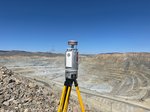
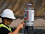
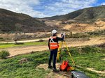
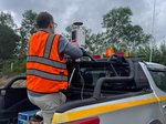
TERRESTRIAL LASER SCANNING
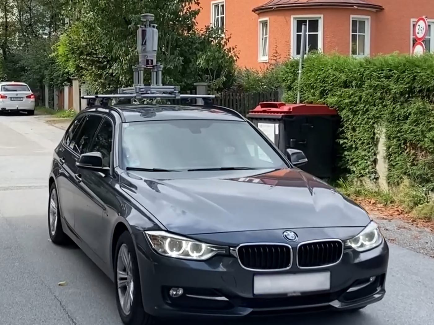
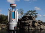
RIEGL VZ-2000i
Based on a future-oriented, innovative processing architecture, internet connectivity, and RIEGL's latest waveform processing LiDAR technology, the RIEGL VZ-2000i Long Range 3D Laser Scanning System combines proven user friendliness in the field with fast and highly accurate data acquisition.
Long Range, Very High Speed 3D Laser Scanner
Its processing architecture enables execution of different background tasks (such as point cloud registration, geo- referencing, orientation via integrated Inertial Measurement Unit, etc.) on-board in parallel to the simultaneous acquisition of scan data and image data. A full documentation of the scanner‘s software components – directly accessible on the RIEGL VZ-2000i – provides a sound basis for creation of your own python apps to enhance the scanner functionality. The system provides highest flexibility by supporting numerous peripherals and accessories such as the integrated GNSS unit for high accurate RTK solution, a SIM Card slot for 3G/4G LTE, WLAN, LAN, USB, and different other ports of external units.
RIEGL's unique Waveform-LiDAR technology is the key to enabling such high speed, long range, high accuracy measurements even in poor visibitlity and demanding multi-target situations caused by dust, haze, rain, vegetation, etc.
For operating the scanner and for data processing, RIEGL offers the well established software package RiSCAN PRO. Different license levels and plugin module licenses allow an adaption to the user specific requirements.
Main Features
- High laser pulse repetition rate of up to 1.2 MHz
- High speed data acquisition up to 500,000 measurements/sec
- Eye safe operation at Laser Class 1
- Wide field of view, 100°x360°
- Range up to 2500 m, accuracy 5 mm
- High accuracy, high precision ranging based on echo digitization, online waveform processing, and multiple-time-around processing
- innovative processing architecture for data acquisition and simultaneous geo-referencing in real-time
- Automatic on-board registration
- simultaneous image and scan data aquisition
- Cloud connectivity via Wi-Fi and 3G/4G LTE
- Integrated IMU for pose estimation and kinematic data acquistion
- Multiple target capability
- Optional waveform data output
- Remote control
- Integrated GNSS receiver
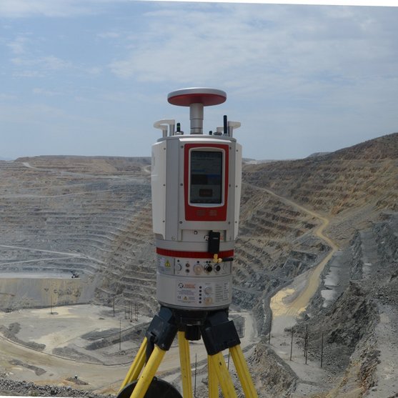
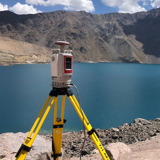
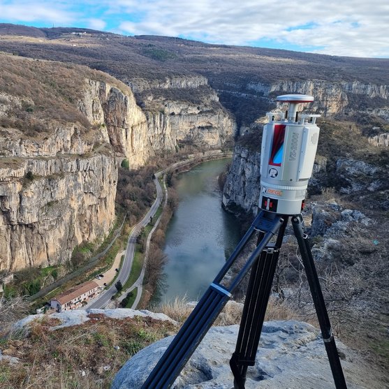
Main Applications
- Topography & Mining
- Natural Hazard Surveying
- Monitoring
- Construction Site Monitoring
- Archeology & Cultural Heritage Documentation
- City Modeling
- Tunnel Surveying
- Civil Engineering
- Research
- Stand-alone Static and Kinematic Laser Scanning
Technical Data Overview
| Laser Pulse Repetition Rate PRR (peak) | 50 kHz | 100 kHz | 300 kHz | 600 kHz |
|---|---|---|---|---|
| Max. Measuring Range (p ≥ 90%) | 2500 m | 1850 m | 1100 m | 800 m |
| Max. Measuring Range (p ≥ 20%) | 1300 m | 950 m | 540 m | 380 m |
| Minimum Range | 2 m | 1.5 m | 1.5 m | 1.0 m |
| Max. Number of Targets per Pulse | 15 | 15 | 15 | 8 |

Software for RIEGL VZ-2000i
We complement our high-performance hardware with innovative software packages to create powerful solutions for demanding applications. The RIEGL software packages are exclusively bundled with the appropriate RIEGL laser scanners and laser scanning systems. For this RIEGL product we provide:
Explore some selected pointcloud samples.
For use with the RIEGL VZ-2000i, special plugins, apps, and libaries are provided :
- RiPANO
to explore your project and to extract plots in your browser - RIEGL LIS GeoTec Plugin
for geotechnical analysis of scanned rock surfaces - RIEGL LIS TreeAnalyzer Plugin
for the automatic extraction of various individual tree parameters in forestry - RIEGL VZ-i Series App
to control your RIEGL VZ-i Series laser scanner system remotely - RIEGL VZ-i Monitoring Apps
for real-time analysis and data processing in diverse monitoring and mining applications - RIEGL VZ-i Series Kinematic App
to use your terrestrial laser scanner for kinematic data acquisition - RiVLib
for developing custom software - RDBLib
for reading and writing various types of data - VZ-i ROS Driver
designed to help developers build robot applications
Download Area & Further Information
RIEGL VZ-2000i
Case Studies


RIEGL VZ-2000i
Gallery


RIEGL VZ-2000i
News & Insights


CONTACT
Get in touch.
Our team is happy to answer any questions you may have about RIEGL products and solutions. For technical support or general inquiries, please use the contact details below.
Technical Support:
support@rieglusa.com
+1 (407) 248 9927
+1 (321) 474 2518 (After Hours)
General Questions:
info@rieglusa.com
+1 (407) 248 9927
Looking for more information?
Send us your request using the product inquiry form.