NEWS, TECHNOLOGY
RiSCAN PRO 2.23: Major Update with Advanced Features for Laser Scan Data Processing and Analysis
With the latest releases of RiSCAN PRO, we are able to offer additional tools to enhance the capability of RIEGL’s software suite for terrestrial laser scanning.

Here are some special tools that we would like to draw your attention to:
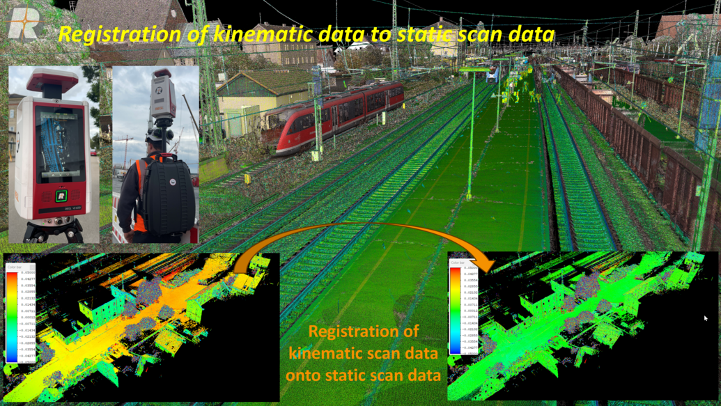
- Registration of kinematic data to static scan data
RiSCAN PRO 2.23 now allows external plane patches (e.g., from a georeferenced static scan) to be provided as control information for the “refinement step,” enabling accurate registration of kinematic scan data to static scan data.
- Support for coloring kinematic scans
Photos taken during kinematic data capture with a mounted SONY ILX camera can now be imported into RiSCAN PRO 2.23. These images and trajectory information can then be used to color kinematic point clouds.

- Tools for floor flatness analysis
RiSCAN PRO 2.23 includes a wizard and auxiliary tools for analyzing the flatness of horizontal surfaces, such as concrete floors. These include advanced filters for pre-georeferencing, a new 3D tool for defining locally leveled coordinate systems, and the wizard itself, which performs “gap under the straightedge”-analysis in the X and Y directions of the floor.

- GNSS post-processing for static scans
With this new release, RiSCAN PRO 2.23 extends support for GNSS post-processing of static scans. If raw GNSS data is recorded during data acquisition and suitable base station data is provided, GNSS post-processing can improve the individual scan position's initial position and thus registration accuracy and overall data quality.

The current version of RiSCAN PRO 2.23 is available for download in the RIEGL Members Area.
If you have any further questions, don’t hesitate to contact support@riegl.com .
The RIEGL Team


