
MOBILE LASER SCANNING
RIEGL VMY-2
The RIEGL VMY-2 is a compact, economically priced Dual Scanner Mapping System, that is well suited for a variety of mobile mapping applications.
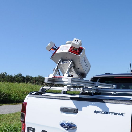
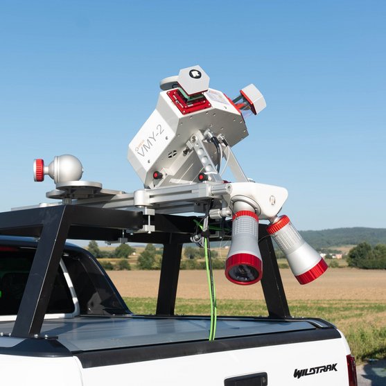
Compact Dual Scanner Mobile Mapping System
The VMY series uses the innovative design of the fold-down laser scanning platform to improve the user mounting and storage experience. The VMY-2 system operates RIEGL miniVUX-HA dual scanners allowing for a reduction in scan shadows along road and railways. The system supports the optional integration of up to four cameras and allows simultaneous acquisition of imagery to complement the captured LiDAR data. This dual sensor platform is unique for providing high quality data at lower pules rates, which enables quicker data transfer and processing speeds.
Ideal users include those engaged in city and corridor mapping, as well as asset management and data acquisition efforts. The VMY-2’s operating cost is highly competitive, making it well-positioned for market success.
Main Features
NEW SURVEY-GRADE SCANNER PERFORMANCE
- 4 mm Precision / 5 mm Accuracy
- High laser pulse repetition rate of up to 600 kHz
- 300 scan lines per second
- Range 270 m
- Eye safe operation at Laser Class 1
- Field of view 360°
- Multiple target capability
- IMU/GNSS system fully integrated
- Optional integration of up to 4 cameras
Main Applications
- GIS Mapping and Asset Management
- Transportation Infrastructure Mapping
- HD Mapping for Autonomous Vehicles
- City Modeling
- Rapid Capture of Construction Sites and Bulk Material
- Open-Pit Mine Surveying
- As-Built Surveying
Technical Data Overview
| Effective Measurement Rate | 200 kHz | 400 kHz | 600 kHz |
|---|---|---|---|
| Max. Range, Target Reflectivity (p ≥ 80%) | 270 m | 240 m | 200 m |
| Max. Range, Target Reflectivity (p ≥ 60%) | 240 m | 210 m | 170 m |
| Max. Range, Target Reflectivity (p ≥ 20%) | 140 m | 120 m | 100 m |
| Minimum Range | 1 m | 1 m | 1 m |
| Max. Number of Targets per Pulse | 5 | 5 | 5 |
| Accuracy / Precision | 5 mm / 4 mm | 5 mm / 4 mm | 5 mm / 4 mm |
Software for RIEGL VMY-2
We complement our high-performance hardware with innovative software packages to create powerful solutions for demanding applications. The RIEGL software packages are exclusively bundled with the appropriate RIEGL laser scanners and laser scanning systems. For this RIEGL product we provide:
These RIEGL software packages are complemented by special libraries (RiVLib, RDBLib) and plugins (RiMAP Plugin for ArcGIS).
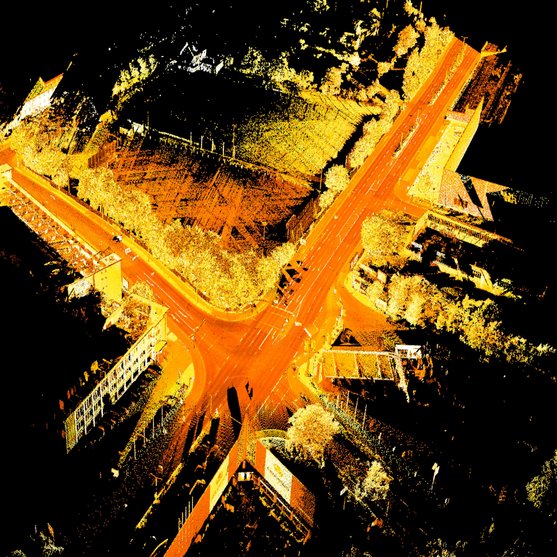
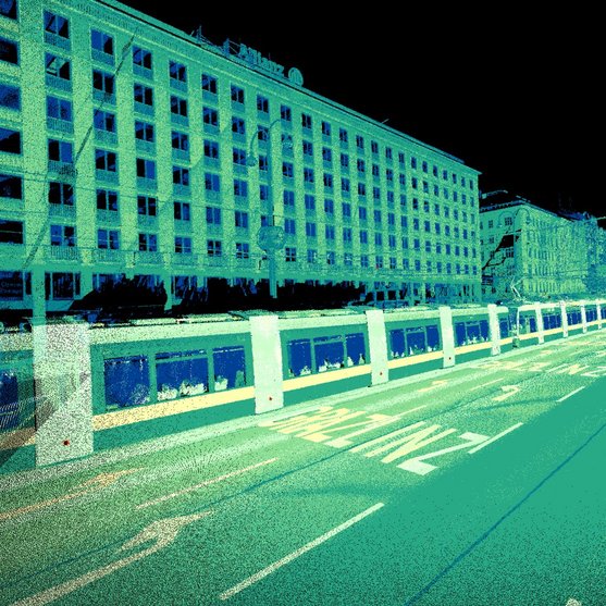
Explore some selected pointcloud samples.

RIEGL VMY-2
Gallery


RIEGL VMY-2
News & Insights


CONTACT
Get in touch.
Our team is happy to answer any questions you may have about RIEGL products and solutions. For technical support or general inquiries, please use the contact details below.
Technical Support:
click here
General Questions:
sales@riegl.co.uk
+44 (0) 1904 217785
Looking for more information?
Send us your request using the product inquiry form.