

With a new line of ultimate survey-grade airborne scanners especially developed for UAV/UAS/RPAS-based applications RIEGL revolutionizes the commercial and civil market providing first-class technique for this new dynamic topic.
UAV-BASED SCANNING
Products
MEDIUM AREA MAPPING

RIEGL VUX-24024
HIGHEST SCAN SPEED

RIEGL VUX-18024
NFB-SCANNING

RIEGL VUX-16023
NFB-SCANNING

RIEGL VUX-12023
EXTRA LARGE FIELD OF VIEW

RIEGL VUX-10025
360° FIELD OF VIEW

RIEGL VUX-1UAV22
ENTRY LEVEL

RIEGL miniVUX-1UAV
ENTRY LEVEL

RIEGL miniVUX-3UAV
ECONOMY VERSION

RIEGL VQ-840-GE
ENTRY LEVEL SYSTEM

RIEGL VUX-820-G NEW
HIGHEST DEPTH PERFORMANCE

RIEGL VQ-860-G
HIGH PERFORMANCE

RIEGL VQ-840-GL
Not sure which product is right for you? Find the right product for your application with our
UAV-BASED SCANNING
Case Studies


UAV-BASED SCANNING
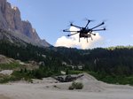
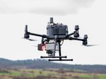
Gallery


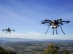

.© Alto Drones")

UAV-BASED SCANNING
News & Insights


CONTACT
Get in touch.
Our team is happy to answer any questions you may have about RIEGL products and solutions. For technical support or general inquiries, please use the contact details below.
Technical Support:
click here
General Questions:
sales@riegl.co.uk
+44 (0) 1904 217785
Looking for more information?
Send us your request using the product inquiry form.