


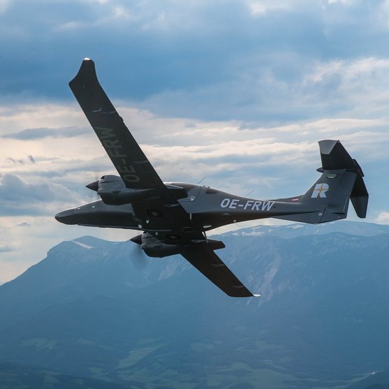
AIRBORNE LASER SCANNING
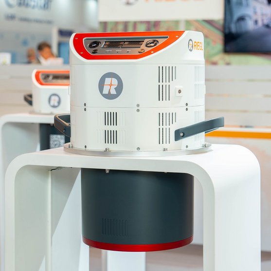
RIEGL VQ-1560 III-S
The VQ-1560 III-S is the latest successor in the proven RIEGL dual channel laser scanning system series, suitable for a wide field of applications – from high-point density wide area mapping to ultra-high resolution city mapping or corridor mapping.
HIGH POINT DENSITY MAPPING AND ULTRA-WIDE AREA MAPPING
Dual Channel Waveform Processing Airborne LiDAR Scanning System
The well-established “cross-fire” scan pattern – with two scan lines rotated against each other – enables a forward and backward view to the edges of the swath and a nadir view in the middle of the swath. High pulse repetition rates of up to 4.4 MHz enable operational flying altitudes of up to 1,600 m AGL, or up to 3,900 m AGL at a pulse repetition rate of 560 kHz (all values given for 20% target reflectance). Laser pulse repetition rates can be fine-tuned in 12-kHz-steps, which enables subtle optimization of acquisition parameters in order to meet specific project requirements.
Online-waveform processing and full-waveform processing capabilities are standard methods for target detection. Scan data and camera images are stored on removable hard disks that can be accessed directly on the device, eliminating the need for an external data recorder.
A high-performance IMU/GNSS unit and one or two optional high resolution RGB/NIR cameras are seamlessly integrated in the compact and user-friendly designed housing. The standardized mounting flange fits typical hatches or gyro-stabilized leveling mounts for maintaining optimum point distribution.
Both, the scan pattern and its wide operational range make the instrument one of the most versatile airborne laser scanner on the market today. It is perfectly suited for any kind of application – from ultra-dense corridor mapping from low altitudes, over high resolution city mapping with minimum shadowing effects in narrow street canyons, to large-scale wide area mapping at utmost efficiency of up to 1,130 km² per hour at a density of 4 points per square meter.
Main Features
- high pulse repetition rates of up to 4.4 MHz
- up to 2.93 million measurements per second on the ground
- best point distribution for optimum target sampling
- atmospheric clutter suppression
- multiple target capability
- online waveform processing and full waveform data recording
- increased sample block lengths
- on-board graphical user interface for easy access to primary scanner parameters
- integrated inertial measurement unit and GNSS receiver
- prepared for the integration of up to two high resolution RGB/NIR cameras
- optimized for interfacing with typical hatches and stabilized platforms
- detachable handgrips for facilitated handling

Main Applications
- Ultra Wide Area / High Altitude Mapping
- Ultra-High Point Density Mapping
- Mapping of Complex Urban Environments
- Glacier & Snowfield Mapping
- City Modeling
- Mapping of Lakesides & River Banks
- Agriculture & Forestry
- Corridor Mapping
Technical Data Overview
| Laser Pulse Repetition Rate PRR (peak) | 2 x 270 kHz | 2 x 500 kHz | 2 x 1000 kHz | 2 x 2200 kHz |
|---|---|---|---|---|
| Max. Measuring Range (p ≥ 60%) | 7040 m | 5670 m | 4370 m | 3180 m |
| Max. Measuring Range (p ≥ 20%) | 4740 m | 3720 m | 2800 m | 1990 m |
| Minimum Range | 1 m | 0.5 m | 0.5 m | 0.5 m |
| Max. Number of Targets per Pulse | 31 | 31 | 15 | 7 |
| 3D Position Accuracy | 3 mm @ 50 m, 5 mm @ 100 m | 3 mm @ 50 m, 5 mm @ 100 m | 3 mm @ 50 m, 5 mm @ 100 m | 3 mm @ 50 m, 5 mm @ 100 m |
Software for RIEGL VQ-1560 III-S
We complement our high-performance hardware with innovative software packages to create powerful solutions for demanding applications. The RIEGL software packages are exclusively bundled with the appropriate RIEGL laser scanners and laser scanning systems. For this RIEGL product we provide:
These RIEGL software packages are complemented by special libraries (RiVLib, RDBLib) and plugins (RiMAP Plugin for ArcGIS).
Explore some selected pointcloud samples.


CONTACT
Get in touch.
Our team is happy to answer any questions you may have about RIEGL products and solutions. For technical support or general inquiries, please use the contact details below.
Technical Support:
click here
General Questions:
sales@riegl.co.uk
+44 (0) 1904 217785
Looking for more information?
Send us your request using the product inquiry form.