NEWS, PRESS
In the News: RIEGL LiDAR Selected to Map Bottom-Surface Morphology of the Great Salt Lake

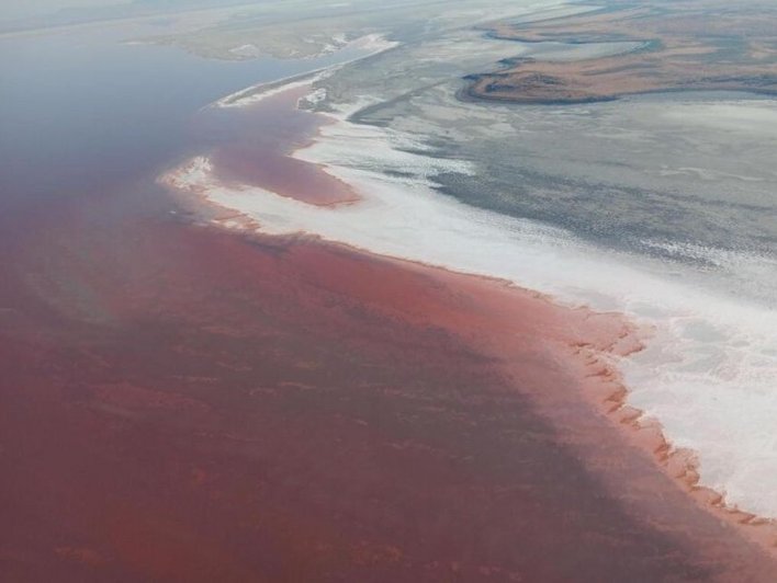
RIEGL LiDAR technology is at the forefront of a pioneering initiative to map the Great Salt Lake, one of North America’s most ecologically and hydrologically significant inland water bodies. In collaboration with Aero-Graphics, Dewberry, Revolution Flight, and the Utah Department of Natural Resources, high-resolution elevation data of both the lakebed and surrounding terrain was collected using the RIEGL VQ-880-G II topo-bathymetric LiDAR sensor.
Watch the Fox 13 Salt Lake City News video below highlighting this initiative:

The RIEGL VQ-880-G II is a state-of-the-art airborne LiDAR system designed for the simultaneous and seamless collection of both topographic and bathymetric data. It features:
- Dual-wavelength LiDAR (i.e. 1064 and 532 nm) for capturing both land and underwater surfaces in a single flight.
- A high laser pulse rate and scan speed, enabling the collection of high-density point clouds for improved sub-surface detail.
- An integrated high-accuracy INS/GNSS system for precise georeferencing and accurate 3D positioning.
- A form factor that supports compatibility with gyrostabilized platforms.
- Embedded high-resolution medium format camera options (i.e. RGB/NIR).

This advanced technology was essential for addressing the challenges posed by the lake’s declining water levels, which had exposed inconsistencies in existing bathymetric data. Updated mapping is critical for accurate water volume calculations, hydrological modeling, and long-term conservation planning.
The joint team’s efforts resulted in the discovery of previously undocumented features on the lakebed, including mounded formations that may indicate groundwater upwelling. These findings offer new insights into the lake’s hydrological behavior and its potential connections to regional aquifers.
This initiative not only enhances scientific understanding of the Great Salt Lake but also demonstrates the potential for similar mapping efforts in other saline or endangered lakes. RIEGL remains committed to supporting environmental research and geospatial innovation through its state-of-the-art LiDAR solutions.
This article and corresponding images are based on several recent sources, including coverage from FOX 13 Salt Lake City and the Aero-Graphics Blog, both of which highlight the collaborative efforts and technological innovation driving this important environmental project.


