TECHNOLOGY, CASE STUDY
TPU Estimation for Bathymetric LiDAR

In this paper, a tool for Total Propagated Uncertainty (TPU) estimation is presented, as implemented feature of a bathymetric LiDAR processing software. The algorithm of the TPU Estimator is based on an approach alternative to existing methods. The concept of the novel approach is described, compared with and validated against an established tool. Two examples from different coastal surveys (Baltic Sea beach of Nienhagen near Rostock, Germany, and coast of Rovinj, Croatia) document the application of TPU estimation and allow to observe systematic tendencies of the results. For the data acquisition the topo-bathymetric laser scanners RIEGL VQ-880-G, VQ-840-GE, and VQ-860-G have been used.
The potential for further improvement is discussed and it is considered how to embed TPU estimation into a user interface to generate expressive deliverables as part of hydrographic survey quality verification. An outlook for possible use of LiDAR TPU estimation apart from a-posteriori quality control and outline further development projects is given.
The presentation was given during the “3D Underwater Mapping from Above and Below – 3rd International Workshop”, 8–11 July 2025, TU Wien, Vienna, Austria and is published in the International Archives of the Photogrammetry, Remote Sensing and Spatial Information Sciences, Volume XLVIII-2/W10-2025, and can be found here.
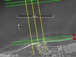
Please see below images from this presentation: