

MORE THAN JUST CREATING MAPS
High-precision data of large regions or entire ecosystems are needed in various fields and industries, such as urban planning, environmental monitoring, navigation, disaster management, or mining.
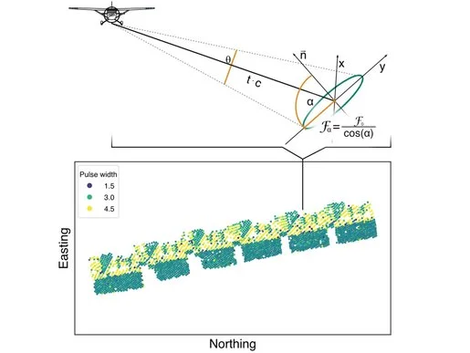
The use of LiDAR makes it possible to measure the earth's surface with high accuracy and efficiency, providing the necessary data for the creation of 3D models of large regions, including dense forests or urban environments. RIEGL's extremely long-range terrestrial laser scanners are already proving their efficiency in applications in the Antarctic or in South American and Indian open-cast mines. RIEGL's high-precision airborne mapping systems provide the data for mapping entire countries or for surveying mountain ranges and water catchment areas.
CARTOGRAPHY & WIDE AREA MAPPING
Products

RIEGL VZ-2000i

RIEGL VZ-4000i25

RIEGL VQ-1560 III-S

RIEGL VQ-1460

RIEGL VQ-1260

RIEGL VQ-1060

RIEGL VQ-780 II-S

RIEGL VQ-680

RIEGL VQ-580 II-S

RIEGL VQ-480 II

RIEGL VUX-24024

RIEGL VQX-2 Helicopter Pod

RIEGL VQX-1 Wing Pod

RIEGL VUX-18024

RIEGL VUX-16023

RIEGL VUX-12023

RIEGL VUX-10025

RIEGL VUX-1UAV22
Not sure which product is right for you? Find the right product for your application with our
CARTOGRAPHY & WIDE AREA MAPPING
Case Studies


CARTOGRAPHY & WIDE AREA MAPPING
News & Insights


CONTACT
Get in touch.
Our team is happy to answer any questions you may have about RIEGL products and solutions. For technical support or general inquiries, please use the contact details below.
Technical Support:
support@rieglcanada.com
General Questions:
info@rieglcanada.com
+1 (0)519-603-3904
Looking for more information?
Send us your request using the product inquiry form.