
AIRBORNE LASER SCANNING
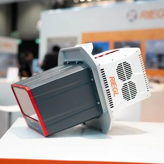
RIEGL VQ-680
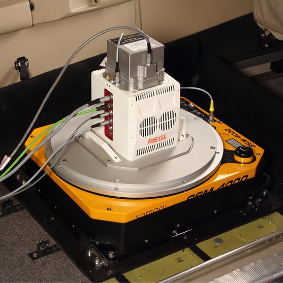
The VQ-680 is a compact airborne laser scanner optimized for urban mapping, forestry and power line survey applications – or wherever high-precision, high-accuracy surveying of complex environments are required. The scanner’s vertical design and small aperture dimensions enable a compact integration with digital cameras in combination with a gyro-stabilized mount, for installation into typical aircraft hatches.
WITH NFB (NADIR/FORWARD/BACKWARD)-SCANNING
High-End Online Waveform Processing Airborne LiDAR Scanner
The laser scanner module includes an innovative scanning mechanism that provides forward, nadir, and backward scan lines at +20 / +10 / 0 / -10 / -20 degrees in the flight direction. In combination with a wide horizontal field of view of 60 degrees, a regular point spacing for each viewing direction is generated, enabling exceptional coverage of vertical structures such as building facades as well as coverage at the bottom of narrow street canyons with little to no shadowing.
The operational envelope ranges from typical flying altitudes of 1,000 m AGL at a pulse repetition rate of 2.4 MHz (~ 24 pts/m2 at 120 kts), up to 2,300 m AGL at a PRR of 300 kHz for targets with reflectivity in excess of 20%.
Electrical interfaces comprise a power supply, time synchronization with PPS and NMEA data, a laser safety switch, and interfaces for connecting up to six high-resolution RGB/NIR cameras. Detachable handgrips improve user ergonomics when mounting to airborne platforms. Scan data is stored on an external PC via Gigabit Ethernet, which is also used for configuring and controlling the laser scanner via RiACQUIRE, RIEGL‘s versatile data acquisition software GUI, featuring real-time data visualization and remote control capabilities.
Main Features
- high pulse repetition rates of up to 2.4 MHz
- up to 2 MHz measurements on the ground
- forward / nadir / backward scan directions at +20 / +10 / 0 / -10 / -20 degrees
- wide field of view of 60 degrees
- excellent atmospheric clutter suppression
- multiple target capability
- online waveform processing
- prepared for the integration of up to 6 high resolution RGB/NIR cameras
- optimized for interfacing with typical hatches and stabilized platforms

Main Applications
- Mapping of Complex Urban Environments
- City Modeling
- Ultra-High Resolution Mapping
- Oblique Mapping of Vertical Structures
- Corridor Mapping
Technical Data Overview
| Laser Power Level | 100 % | 100 % | 100 % | 100 % |
|---|---|---|---|---|
| Laser Pulse Repetition Rate PRR (peak) | 300 kHz | 600 kHz | 1200 kHz | 1800 kHz |
| Max. Measuring Range (p ≥ 90%) | 3020 m | 2310 m | 1740 m | 1450 m |
| Max. Measuring Range (p ≥ 20%) | 4470 m | 3510 m | 2710 m | 2310 m |
| Minimum Range | 20 m | 20 m | 20 m | 20 m |
| Max. Number of Targets per Pulse | 32 | 24 | 11 | 7 |
Software for RIEGL VQ-680
We complement our high-performance hardware with innovative software packages to create powerful solutions for demanding applications. The RIEGL software packages are exclusively bundled with the appropriate RIEGL laser scanners and laser scanning systems. For this RIEGL product we provide:
These RIEGL software packages are complemented by special libraries (RiVLib, RDBLib) and plugins (RiMAP Plugin for ArcGIS).
Explore some selected pointcloud samples.


CONTACT
Get in touch.
Our team is happy to answer any questions you may have about RIEGL products and solutions. For technical support or general inquiries, please use the contact details below.
Technical Support:
support@riegl.com.au
General Questions:
australia@riegl.com.au
+61 07 5681 2122
Looking for more information?
Send us your request using the product inquiry form.