NEWS, CASE STUDY
A Mix of Technologies Leads to Success: Innovative Structural Surveying, Using a Suspension Bridge in Passau as an Example
Multi-technology is increasingly becoming the key to building surveying. With this project, the engineering firm Wolf from Vorra, Germany, demonstrates how the use and combination of different technologies enable highly precise as-built documentation while simultaneously laying the foundation for future planning, renovation, and monitoring through the creation of a photorealistic digital twin.

Ingenieurbüro Wolf, based in Vorra, Germany, offers its clients high-quality surveying data and customized post-processing services − ranging from terrestrial data collection and aerial surveying to the final data product.
The project “Survey of the Passau Suspension Bridge” now provides a detailed documentation and visualization of how a wide variety of technologies are skillfully deployed and combined to best achieve the project’s objectives.
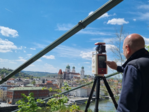
The terrestrial RIEGL VZ-600i 3D laser scanner was used for the static and kinematic acquisition of measurement and image data. In our article, we will focus specifically on the contribution of laser scanning to the overall project.
Renovation or New Construction?
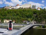
The suspension bridge over the Danube was rebuilt in 1948. It connects Passau’s Old Town in the south with the B12 in the north and has a span of approximately 117 meters. Since a visual inspection of the cables in 2025 revealed that the structure is no longer structurally sound, a weight limit was imposed.
Renovation or new construction? In an innovative surveying project, the entire structure − from the top and bottom surfaces, through the adjacent masonry and rock walls, to the anchor points in the caverns − was surveyed and analyzed with high precision. This made it possible to provide highly accurate and reliable data to support the decision-making process.
Impressive Highlights of Surveying and Visualization
Key points of the survey:
+ UAV-based surveying
+ terrestrial laser scanning (static) using the RIEGL VZ-600i at 77 scan positions
+ boat-based laser scanning (kinematic) using the RIEGL VZ-600i for the underside of the bridge
+ mobile scanning of the caverns using a XGrids handheld scanner
Key points of the visualization:
+ photogrammetric survey of the underside of the bridge (orthophoto)
+ 3D Modeling of the caverns and their surroundings using Gaussian Splatting
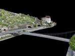
+ 3D Modeling of the bridge and the adjacent urban area for visualizing the new building using Gaussian Splatting
(see here the corresponding 3D model and here a short video)
| Technology | Application | Result | Parameters |
| RIEGL VZ-600i (static) | top of the bridge | point cloud | 336000 points/sqm 1.7 mm point spacing |
| RIEGL VZ-600i (kinematic) | underside of the bridge (using a boat) | point cloud | 87800 points/sqm 3.3 mm point spacing |
| high-resolution camera | underside of the bridge | orthophoto | GSD 1.6 mm/pixel (orthophoto) |
| survey drone | top of the bridge + surroundings | point cloud, orthophoto, 3D Gaussian Splatting | GSD 1.1 cm/pixel (orthophoto) |
| hand-held scanner XGrids | caverns (anchorage points) | 3D-model, point cloud | fotorealistisch, begehbar; rel. Genauigkeit ab ~1cm |
| Emlid RS2 & RS4 Pro | geodetic reference | control points | absolute accuracy starting at ~1cm |
Static and Kinematic LiDAR Data: The RIEGL VZ-600i in Action
The top of the bridge was scanned using the RIEGL VZ-600i, a latest-generation terrestrial laser scanner. The scanner sets new standards in precision, range (up to 1,000 m), and efficiency. With a measurement rate of up to 2.2 MHz and a 3D positional accuracy of 3 mm in under 30 seconds per scan, it delivers highly detailed point clouds—ideal for complex structural surveys and BIM applications.
77 scan positions at the top of the bridge ensured seamless coverage with 336,000 points per m² at an average point spacing of 1.7 mm.
The point cloud serves as the basis for digital as-built documentation as well as for planning renovation or new construction projects.

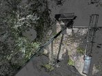
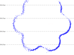
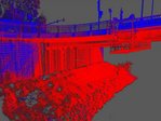
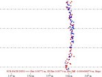
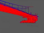
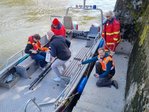
The underside of the bridge is difficult to access. Here, data was collected from a boat using the kinematic mode of the RIEGL VZ-600i. The kinematic scan delivers an impressive point density of 87,800 points per sqm with an average point spacing of 3.3 mm. At the same time, a high-resolution camera was used to generate an orthophoto of the underside of the bridge with a resolution of 1.6 mm/pixel. The point cloud from the laser scanner and the orthophoto complement each other perfectly to provide a complete digital representation.
The Mix of Technologies
In addition to the data collected using the VZ-600i, the anchor points of the steel cable structure in the four caverns were captured using portable handheld scanners and incorporated into the overall model.
Furthermore, the bridge and the surrounding area were surveyed using drones. The resulting point cloud and orthophoto were used to create a comprehensive digital twin.
Two GNSS receivers were used for the geodetic integration and validation of the data.
The combination of these various technologies enables seamless, high-precision, and multidimensional data collection. We were able to provide a complete, validated 3D model as the basis for renovation planning as well as—if necessary—for new construction planning. Furthermore, the data serves as a solid foundation for tracking deformations or damage as part of ongoing long-term monitoring.
Conclusion: Multi-technology is the Key to the Future of Building Surveying
The project in Passau has shown that: Modern building surveying requires the intelligent use of various technologies − from terrestrial laser scanning to mobile and handheld systems, as well as drones and GNSS. Combining these methods not only enables high-precision as-built documentation, but also the creation of photorealistic digital twins, which are indispensable for planning, renovation, and monitoring.
We would like to thank Alexander Wolf, Dipl.-Ing. (univ), and the partners involved for giving us the opportunity to showcase this project here.
You can find the original article (in German language) with further details on the website of Wolf Engineering.


